How The Heck Do I Make An ImageMap That Works?
Recommended Software:
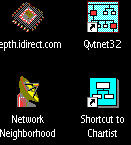
After you have downloaded Mapedit, you will have to decide what graphic you
will use as your navigational tool. The one that was selected here is a
screen capture of a Win '95 desktop.
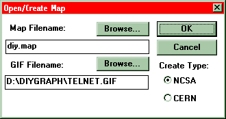
Launch MapEdit and enter in the location you wish to store you .map file
andwhere the graphic you wish to map is located. Be sure that you have the
NCSA button selected, or the format of your map will be incorrect.
Now the difficult part is selecting the proper area of the screen that you
wish to make clickable. Simply click on "Tools" on the menu bar, then select
the shape that you wish to use, and then drag the cursor around the area you
wish to make clickable within the graphic window. To finalize your
selection, right click n your mouse button, and the following window will
pop up.
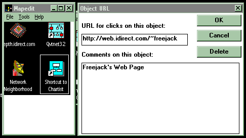
This window is the one that allows you to specify what location is loaded
into the clients browser when the area in question is clicked. In this case,
clicking on the "Recycling Bin" will load the Freejack's Home Page. Note
that the comments area is not a mandatory field, but it makes things easier
should you wish to change the maps manually at a later date.
After you have created your ImageMap, upload them to your public directory
using your FTP program.
After the FTp is completed, the last thing that you must do is link the
graphic and the map together in the .html file so that
when someone clicks on the graphic, everything works the way it should, and
the user is sent off to the html document that you want them to link to.
The only way to do this is to include exactly the line that follows (with
the appropriate changes of course) in your html document.
<A
HREF="http://web.idirect.com/~insertyourusernamehere/insertnameofmapfilehere.map"><img
src="insertnameofgraphichere.gif" ISMAP></a>
If there are any problems with this, check your syntax against what is on
the screen. Most errors occur because of improper configuration, or typos.
Failing that, edit your .map file to ensure that the links and coordinates
are valid.